AdUnit3

Sunday, October 28, 2018

Majestic Malwa


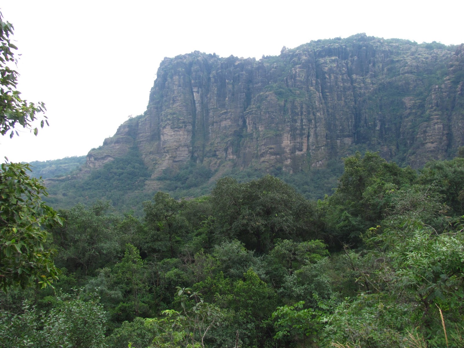
Monsoon is always a good time to visit the central Indian highlands. This is the time of the year when the rolling hills in the region are painted with mossy green and the dark clouds bring the temperature down. This monsoon we decided to visit the Malwa Plateau – the famous highland nestled at the foothills of Vindhya Mountains.

View from Choral Dam
Monsoon Greenery - View from Choral Dam
Malwa is rich in history. It’s the region where the great king Vikramaditya reigned. It’s the birthplace of poet Kalidasa. Later in modern times Malwa rose to prominence once again through the patronage of Rajmata Ahilya Devi, who ruled from Maheshwar near Indore.

We planned for an extended weekend trip of 3 days around Indore covering Choral Dam, Patalpaani waterfall, Omkareswar & Maheshwar.
Choral Dam 

Our trip started with a surprise. Our Jet Airways flight to Indore happened to be their first flight in CCU-IDR route. So we got a grand reception at the boarding gates, we were greeted with chocolates and some beautifully decorated yellow roses, the flowers were really gorgeous. After a couple of hour’s flight when we landed at IDR airport the aircraft was given a salute with water cannons, which were a sight to behold.
We had our car waiting for us at the airport, and drove straight towards Choral Dam & resort which is located near MHOW, around 40 kilometers from Indore.

Local Fishermen at Choral Dam
MHOW cantonment is a treat to watch. It’s a typical squeaky clean cantonment town, with great buildings and history associated with it. We reached Choral resort within an hour. MPTDC has set up a nice sprawling resort by the banks of Choral Dam. The dam has been constructed over the Choral River. During monsoon the lake with dark clouds hovering over the water and wooded hills on the background looked absolutely enticing.

The afternoon was spent with some aimless walk around the lake. Local fishermen were pretty busy looking for their catch on the lake. We saw a lot of them, sailing with their country boat on the vast lake. Boating is also a popular option at Choral. We could see weekend crowd enjoying their ride at the placid waters. A colorful sunset marked the end of our day at Choral.
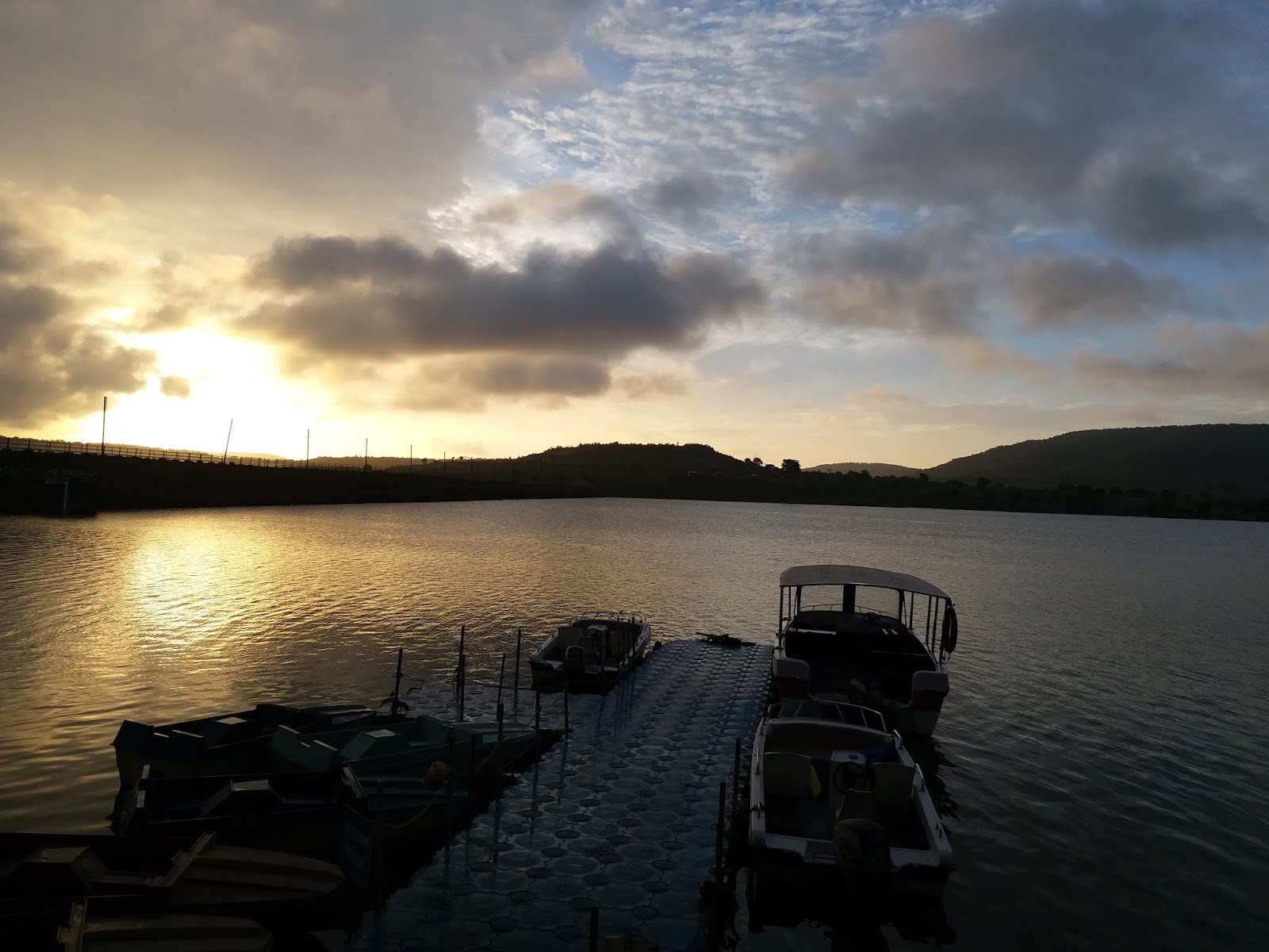
Sunset at Choral Dam
Experiencing a heritage Railway at PatalPani

The next morning our first destination was Patalpaani waterfall. Our added attraction to visit Patalpaani waterfall was to also see the famous meter gauge train chugging along the Vindhya Mountains. The meter gauge track was an engineering marvel from pre independence era. It connected Indore at Malwa plateau with the plains of Maharashtra at Khandwa, crossing the mighty Vindhyas. The route between Patalpaani and Kalakund is the most scenic section of this route where the track winds its way uphill through the ghat section. As a bonus the passengers also get a glimpse of the mighty Patalpaani waterfall from the train.

During monsoon Patalpaani waterfall was at its full glory. At Patalpaani, Choral River, leaps from a height of 300 meters to form this waterfall, and then meanders its way through a narrow ravine in the woods.
Pataalpani Waterfall at Monsoon
As we were enjoying the waterfall, the MHOW – Sanawad meter gauge passenger also arrived and slowly chugged along the ghats. With the plunge of Patalpaani at one side, and the rustic meter gauge train on the other side, it was the most magical picture one could draw in nature’s canvas.   
Meter Gauge Train Patalpani
Sanawad Passenger at Pataalpani

Omkareswar Jyotirlinga

Soon after the train left we started our journey towards Omkareswar. Omkareswar is a busy pilgrimage town on the banks of river Narmada. The famous Jyotirlinga is situated in an OM shaped island in the middle of Narmada, which can be reached via a hanging bridge on foot. The view of majestic Narmada flanked by Vindhya hills on either side, from that bridge is magical.
Narmada at Omkareswar
The Scenic Omkareswar Jyotirlinga
The temple can also be reached via mechanized boat taken from any of the ghats by the banks of Narmada. The boats in this region are pretty colorful and looked pretty enticing in the middle of clear blue Narmada water. The main temple is centuries old but with the ornate carvings in its wall, still looks as majestic as ever.

It was a Sunday, so the place was brimming with pilgrims all over nearby places. There was a long queue in front of the sanctum sanatorium, and it looked standing on that queue might take few hours. So we decided to take VIP tickets sold at a premium, and visited the deity. Not the ideal way to visit the almighty but when you do not have enough time that was possibly the only way out.
Colorful boats dot the Narmada River
The town itself with holy cows, saffron flags, and omnipresent pilgrims looked totally imbued with faith. There is a magic in these kind of place, as it slowly grows on you, and the same happened with us as well. As we spent more and more time at Omkareswar we started to like the madness of the place. But we had to return back to Choral, which is almost a couple of hours drive, so decided to return back well before the sun down.

Next Day - Towards Maheshwar

The next day our destination was Maheshwar, to experience the majestic fort built on the banks of Narmada by Rajmata Ahilyabai.

From Choral we once again had to cross the Vindhya Mountain, this time through the famous Vanchu point, which provided a mesmerizing view of the rolling hills and the plains below.
Vanchu Point Maheswar
Vindhya Mountain from Vanchu Point Maheswar
Compared to Omkareswar, Maheshwar is a sleepy town, centered on the Ahilyabai Fort.

The fort is grand. The fort along with the ghat in front of it has to be the most scenic waterfront in whole India. It oozes heritage. The fort itself is extremely well maintained, with strong walls, & intricately carved temples & pillars. The grandeur of the palace and the temple inside it reminds people of the golden era of the Holkar dynasty, led by Rajmata Ahilyabai.
Ahilyabai fort from ghat
Ahilyabai Fort as seen from the ghat
Ahileshwar temple dedicated to lord Shiva is the main temple complex inside the fort. It’s still an active temple, used by both the local people and the royal family who lives inside the fort complex. The temple with its intricately carved granite walls, is an epitome of the Maratha architecture.
The Legacy of Maheshwar

The majestic fort, and the beautiful ghat with its well-designed stairs going down to the languid Narmada in front of it, creates a picturesque setting. A boat ride along the Narmada to look at the daily chores on the ghats couldn’t have been missed. The boat ride along Narmada offered us the best lookout points to enjoy the majestic beauty of the Ahilyabai fort. Lots of devotees were taking a holy deep in the sacred waters of Narmada. The chants of the devotees, the cool breeze of Narmada and the grandeur of the mediaeval fort on the backdrop created a surreal effect.

Narmada at Maheshwar
The fort as seen from Narmada at Maheshwar
Maheshwar is also famous for the Maheswari Silk sarees. A lot of families here still earn their livelihood by weaving this piece of art. Most of them are completely handmade and the motifs on the Sarees are inspired by the carvings made on the majestic walls of the Ahileshwar temple and Ahilyabai fort.

The tradition of Saree weaving was patronized by Rajmata Ahilyabai, which helped Maheshwar become one of the famous seats for silk sarees in India.

We visited one such weaver’s house and bought us a handmade silk cotton Saree as a memory of visiting this rich historic place. 

Temples of Maheshwar
Temple Carvings Maheswar - which inspires Maheswari Weavers 
We had our flight to Kolkata from Indore that afternoon, so even though we wanted to stay a few hours more, and enjoy a Sandhyarati on the banks of Narmada, we had to give that a miss. So we started our journey back towards home, leaving behind the rich legacy of Malwa. This region with its great blend of natural beauty and rich history, is certainly an important place in our ‘Incredible India’.    

Monday, June 4, 2018

Bharmour - The Abode of Lord Manimahesh


Beauty of  Pir Panjal at Bharmour
Bharmour or Brahmapur was the erstwhile capital of the Chamba kingdom, before it was shifted to Chamba. The town now is the home of Gaddi’s – the nomadic shepherds of the Himalayas. Gaddis driving their herd of sheeps and goats are a common sight in the streets around Bharmour.
We visited Bharmour during the summer of 2018. The road to Bharmour from Chamba is extremely scenic and exciting. The road winds its way alongside the river Ravi or Iravati. It passes though beautiful villages of Chamba which are situated on the banks of Ravi.
Entering Bharmour
We drove till Kharamukh, a small village around 40 km from Chamba, it is where we left the mountain river, and then started climbing the lofty hills of lower Pir Panjal.

The road from Kharamukh to Bharmour is quite narrow, and as we gain altitude, they started loosing vegetation. On one side of the road is a deep ravine, through which Budhil river (originating from the Pir Panjals) flows like a silvery ribbon.
As we drove closer to Bharmour, the snow laden mountains of Pir Panjal started appearing, including a distant view of the famous Manimahesh Kailash peak. Within 2.5 hours we reached Bharmour market. We had our reservation at HPTDC Hotel Gaurikund, which is situated at the Bahrmour helipad – the highest point in Bharmour.
HPTDC Hotel Gaurikund Bharmour
From market a very steep and narrow road lead us to the helipad, the road is so steep, even the experienced local drivers also find it difficult to negotiate the switchbacks.The helipad gives a panoramic view of the lofty hills that surround Bharmour. Even in mid summer, most of the hills had some amount of snow at the top, which looked enticing.
View From Bharmour Helipad

HPTDCs Hotel Gaurikund is pretty nice. The hotel only has 6 rooms. It’s a 3 storied building with the second floor having the Deluxe and Super Deluxe rooms.  We stayed in the deluxe room, which was value for money @1800 per night.The room was big enough with a clear view of the snow peaks, it had a clean bathroom. The staffs are extremely helpful. The food in the hotel is also extremely homely, a rarity when we are travelling.
We had a sumptuous lunch with home-style chicken curry and mixed vegetables.
On the afternoon we visited the famous Chaurasi temple complex, which is a 5 minutes walk down from Hotel GauriKund.

Temple Dedicated to Lord ManiMahesh at Chaurasi temple complex
The famous Chaurasi temple, situated at the centre of the town, represents the rich history and culture of Bharmour. Dated back to 7th century this temple complex has 84 temples dedicated to various gods and goddesses, and hence is named Chaurasi. The main deity here is Lord Manimahesh, who has the biggest temple dedicated to him. The temples are built in typical Pahari style with one main shikhar and a wooden umbrella type crown on top of the stone structure.
The temple complex is an oasis of peace in the town of Bharmour. The temple complex not only serves as a place for rituals, but also serves as a place for community building, it’s the place where people of Bharmour come down, meet each other and discuss their day to day life and culture. It’s the neucleus of Bharmour.
The temple complex is squeaky clean, which certainly adds to the scenic appeal of the place. With lofty snowy mountains on the backdrop the temple complex is definitely the prime attraction in Bharmour.
Our next destination was the Bharmani Mata temple.

Thick Deodar - Bharmani Mata Temple
Bharmour was the abode of Bharmani Mata, and hence the name of the town. According to the legend, when Lord Manimahesh wanted to make Bharmour his abode, the goddess graciously agreed to shift her abode to the upper hills. In return she asked Lord Shiva for a boon- that all his followers who are going on the Manimahesh Yatra should first visit her and take a dip in the pool for their yatra to be valid . This custom is still followed by the pilgrims.
Situated 6 km. uphill and almost 2000 feet above the main town, Bharmani Mata temple overlooks the town and provides some stunning views of the snow clad Pir Panjal range.
We took a cab from the market, to reach the temple. The road to Bharmani Mata temple is extremely treacherous. It’s a narrow and dirt track that climbs uphill like crazy.
Main Temple of Mata Bharmani
The road goes past famous apple orchards of Bharmour around the Malkote village - a gaddi hamlet situated on the higher slopes of the mountain. After crossing Malkote it climbs a further 2 km to reach the ridge where Bharmani Mata temple is located. Since it’s situated on a ridge, the 360 degree view of the surrounding Pir panjal range from the temple is mesmerizing. With the backdrop of thick deodar forest, the temple really looked like the custodian of Bharmour’s rich history and tradition.
Bugyal at Bharmani Mata
The temple complex has the famous Bharmani Kund, where pilgrims take a holi dip, before venturing to the Manimahesh Yatra. The deity of Bharmani Mata is simple, with a divine aura in her eyes. A weeklong langar seva was going on  when we visited the temple. The friendly people of Bharmour didn’t let us go, without having the food at the langar. The Pahari style mixed dal and vegetable curry was delicious, and it tasted even better because of the love and passion with which it was served.
The vistas around the temple was so beautiful that one can spend hours at the top. Pir panjal snow peaks could be visible all around us. The mountain top was actually a green bugyal with domestic horses, grazing on it.
There is another trekking route of 2.5 km that goes down straight from the hilltop to Bharmour Helipad. The vistas on that route is also surreal. So we decided to leave the cab, and started our way back downhill through the trek route. The trek route actually goes down through the Malkote village, which gave us a great opportunity to witness the intricately carved wooden village homes, and the lifestyle of the villagers. Each family boasts of quite a few numbers of Cow, goat and sheep. The wool and milk that they generate from these animals are the main source of their income, along with the apples from the orchards.
The people of the village are so friendly that some of them wanted us to visit their home, and have a tea with us when we were passing through the village. We would have loved to do that, but since it was already late, we wanted to reach our hotel before it gets completely dark, so we had to politely turn down the offer. When we reached our hotel, it was almost dark. It was a long day for us with full of activity. So we had our dinner early and huddled under the quilt for a warm sleep.
Malkote Village Bharmour
The next day, our plan was to visit Kugti Village. Kugti almost 25 km away from Bharmour is the last inhabited village of the Gaddis. The landscape after Kugti is extremely rugged with lofty mountains that rise upto Kugti pass , which is more than 5000 meter high, and separates Chamba from Lahaul.
Pir Panjal near Hadsar
We set out early enough by 8 a.m. It was a sunny day with clear sky, which made the vistas around us even brighter. The road to Kugti goes till Hadsar, the last motor able stop, on the Manimahesh Yatra route. Then an unmetalled road goes down till Dharol, which is a further 7 km from Hadsar. The road from Hadsar to Dharol runs along the Budhil river. After Dharol, it’s another soft trek of 3 km to reach Kugti.
The road from Bharmour to Hadsar is an uphill climb, with Budhil river flowing down the gorge below. The vistas were spectacular, as more and more snow laden mountains started giving us company. We reached Hadsar within 30 minutes. From Hadsar one trek route goes uphill towards the Manimahesh peak. We could see that trek route climbing its way up through thick deodar forest. The route goes alongside a mountain stream named Manimahesh Ganga, which originated from the Manimahesh Kailash peak and meets with Budhil River at Hadsar.
We drove further, crossed Hadsar, and took the unmettaled road that goes to Dharol. However a bad news was waiting for us in the next bend. A landslide which had happened early morning had completely blocked the road. We saw a part of the mountain, which had completely come down to the road. From the magnitude of the slide it looked like the debris couldn’t be removed within a short time, and might take almost a day. We enquired with the local, and they also agreed in unison. More over, some stones were still falling from the mountains, so until it stops completely,  the PwD workers won’t be starting their work to clear the debris.


Manimahesh Ganga at Hadsar
It was a real heart break for us. The road to Kugti looked absolutely enticing, with languid Budhil river on one side and thick deodar forest in the other side. We knew some spectacular vistas were waiting for us in Kugti, but we had to abort our plan. We went down to the Budhil river, enjoyed the icy cold water, took a few snaps and decided to return.

Even though we couldn’t visit Kugti, Bharmour with its natural beauty and friendly people had already won our heart .
The evening was spent on the Chaurasi temple, and the Sandhyarati with the chants and the chimes of the bells made a perfect end note to our soujourn at Bharmour.

Sunday, October 29, 2017

Dhupgarh - The Roof of Satpura


Texan Landscape - Dhupgarh
Pachmarhi is a very well known hill station in Central India. It boasts of verdant forests, rolling hills and murmuring brooks.However the jewel in Pachmarhi's crown is definitely Dhupgarh - the highest point of Satpura, which is also the highest point in Central India.


The Towering Dhoopgarh Peak
We visited Pachmarhi this October & no matter wherever we go, for sightscene, our day wouldn't have been complete without a visit to Dhupgarh on the afternoon. It's almost 9 kilometers from Pachmarhi, and almost couple of thousands higher in altitude. So once you come to Dhupgarh, you can feel the chill, and get to see the vast expanse of Satpura's.


Road to Dhupgarh via Satpura NP


The road to Dhupgarh is stunning. It slowly climbs uphill through the forested slopes of Satpura national park. Apart from the very touristy seasons, this road remains relatively silent, and on the wee hours gives a possibility of an encounter with the wildlife at Dhupgarh. Our Guide, narrated how couple of years back, he met with a raging Bison, on the way back from Dhupgarh in the evening.


He also mentioned that to protect the wildlife, from 2011 the forest department has banned entry of vehicle before 9.30 a.m., which means people can't enjoy the sunrise from Dhupgarh anymore :(
After a short hike
The last 3-4 kilometers of the road is quite steep, and gains height considerably. Once you reach a certain height, there are points, which gives a brilliant panorama of the Satpura hills. We were prepared for some short hikes, and found a real vantage point to enjoy the Sapura's.
Rolling forested hills - Satpura


The verdant rolling hills of Satpura, just after the monsoon, was really a treat to the eyes. We enjoyed the beauty from every nook and corner.


Nagaphani Peak
Just before reaching Dhupgarh, we came across the famous Nagaphani peak. This is a sacred peak for the local people. During Nagpanchami, people from central India, flock to this place for a 12 kilometer hike down to the valley, which is famously known as 'Nagdwari Piligrim Trek'.


The Flats - on the top


Once we reach the top of Dhupgarh, we were utterly surprised. It's a complete flat land. Walking down this forested path, you will never realize, you are actually on top of 4500 feet above MSL. That's the beauty of the Step Mountains.


The Nature Interpretation Center
On the top, there's a nature interpretation center, which boasts of some stunning photographs of the landscape in and around Pachmarhi. It also gives you a glimpse of the lifestyle of the Khorku tribes, which dwells in sleepy villages inside the Satpura National Park.


The famous Sunset with behind the rolling hills


Dhupgarh is famous for its stunning sunsets. After visiting the Nature Interpretation Center, we came to the sunset point, which has a very well laid out gallery, to sit and enjoy the day's end, sipping on a hot cuppa. The sun was already started to go down, and the nip in the air certainly made us realize that we are on a ridge @4500 feet.


The rolling hills on that twilight looked absolutely surreal. As far as we could see, It was the mighty Satpura with its vast expanse.


Satpura @Dusk


As the sun dipped below the horizon, it marked a perfect end to an amazing few hours at the roof of Central India!!


One Last time for the day

Thursday, May 11, 2017

Kanha - In pursuit of the elusive big cat

Barasingha - The success story of Kanha
When we decided to visit Kanha in early may, we were a bit skeptical about the heat.
Poeple said Kanha could be really hot during this time. But at the same time more heat means more chance of animal sighting near the water holes. So we decided to go ahead with the plan.

We booked 3 safaris in Mukki zone, and started our journey via Bilaspur.  We reached Bilaspur from Kolkata via Mumbai mail. We had our travel arrangements done by 'MP Tourism'. The already arranged Innova was waiting for us in Bilaspur station, and we soon started our journey towards Kanha.

Kanha is more than 200 kilometers from Bilaspur, we passed through Bilaspur-Mungeli-Chilpi and reached Kanha after 5 and a half hours.

Kanha Safari Lodge run by MP Tourism
Kanha is situated in an elevated plateau, at 600 - 900 meters above sea level, so even though the plains of Chattisgarh & MP were scorching, the weather in Kanha was more pleasant, the dense forest cover around, also added some respite from the heat.

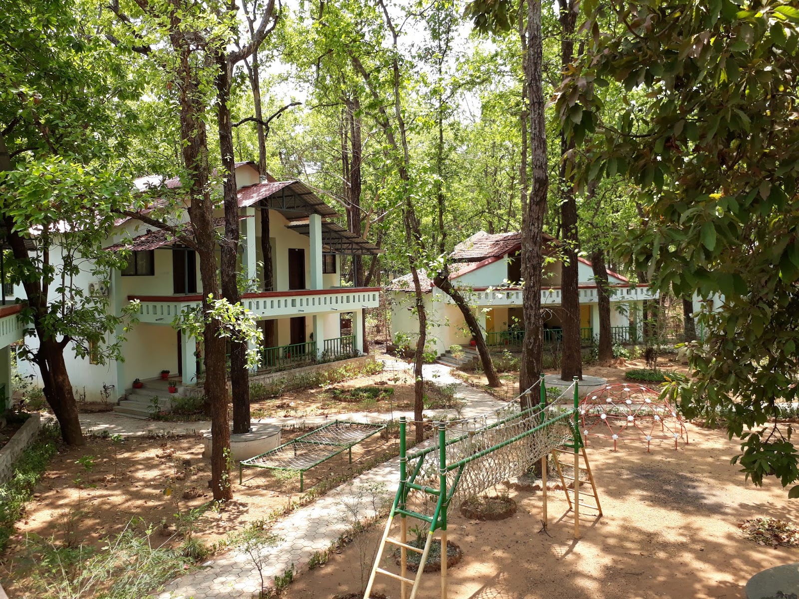
We checked into 'Kanha Safari Lodge' run by 'Mp Tourism'. It's aesthetically built along the banks of river Banjar with all modern amenities. From the private balcony of the rooms one can have a great view of the forest & river. The resort has 6 standalone units, with 3 units having 2 AC deluxe rooms on 1st floor and 2 AC rooms on ground floor.The other 3 units only have 2 AC rooms on ground floor.

Just beside the lodge, along the river, there has been a nature tail created, which runs through the thick woods along the river for almost 2 kilometers. We didn't have any safari booked for that day, so during the afternoon we walked on that trail, occasionally got down at the riverbed and had a splash at the river water. It was quite refreshing.

Banjar River View - From Watchtower


A watchtower has been built on that trail, which gives a good view of the river & the surrounding forest. We climbed to the top floor of the tower and had a nice view of the buffer zone.
At evening we visited the nature interpretation center and saw documentary on Kanha. It was really informative, and depicts how much effort everybody has to put in, to make the project Tiger a success.

Next morning we started our safari from Mukki gate. Saw a group of Barasinghas on the grassland. One of the success story for Kanha is the conservation of Barasinghas.It is the only place in India where Barasinghas can be found. Surviving near extinction, they are now quite a few on numbers in Kanha. Saw this flock on the early morning light.


Flock of Barasingha
The day was a bit cloudy. Probably that's the reason we saw a lot of peacocks dancing with their colorful plumage in display.


The Dancing Peacock
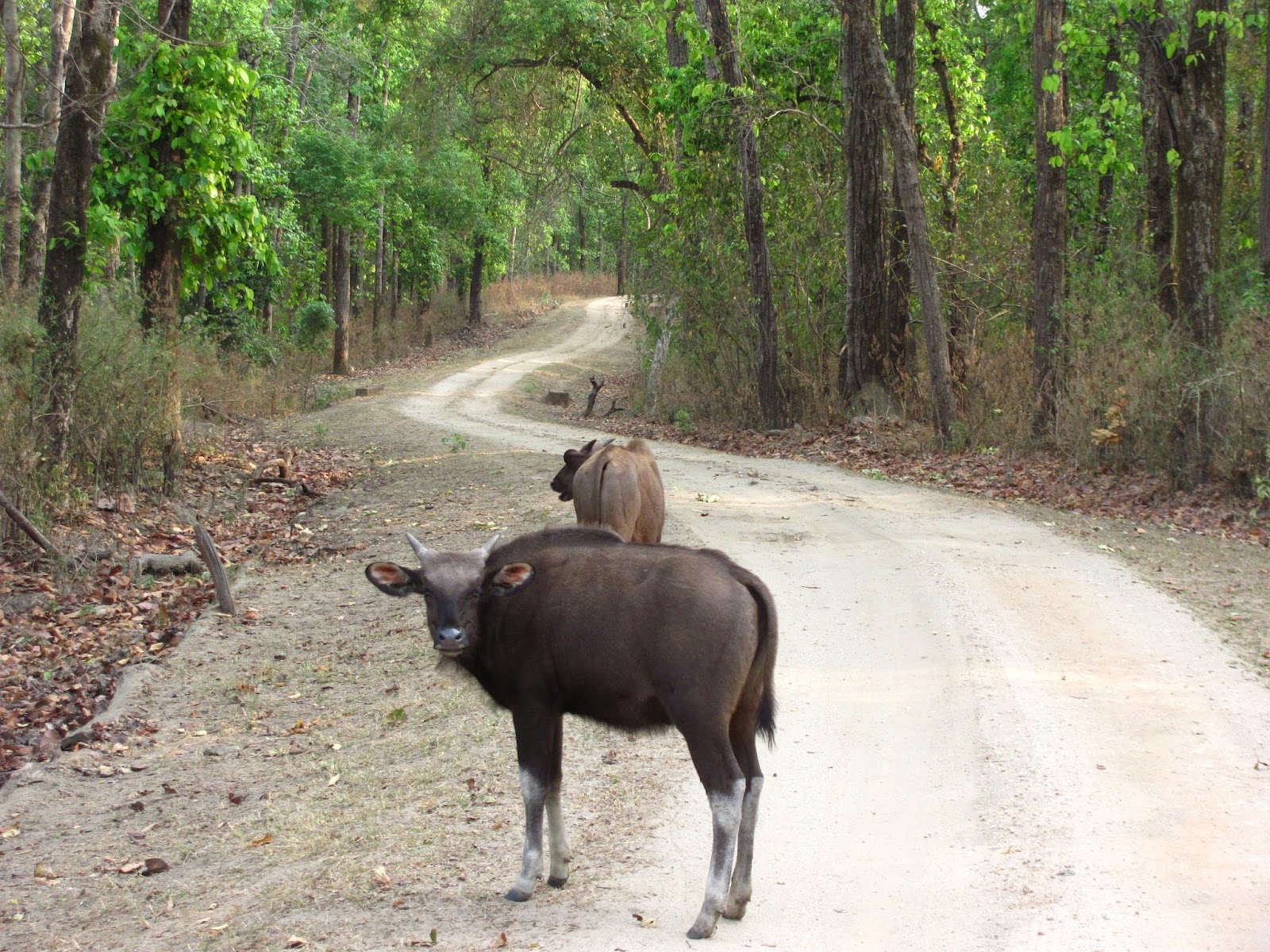
Next on the list was Gaur. As our gypsy got closer to it, it gave us a nonchalant look and then continued with munching on the leaves. It looked like these animals now have got pretty 'used to' with the prying eyes of the tourists.
The Gaur
Kanha meadows & the Barasinghas
The real beauty of Kanha lies in its sprawling meadows. These meadows were mostly created when the villages were relocated from inside the national park area. These meadows are basically grasslands spreading acres. A lot of herbivorous can be seen in those grasslands. Saw these one with a talab (small lake) in the middle. Its a popular place among the Barasinghas, who mainly feed themselves on the algae grown at the waterbody.
The other beauty of Kanha is its luxuriant Sal trees. During the early summer the trees were full of new leaves, giving the entire forest a greener look.
Gaur at Minkur
Over the last few years, Mukki zone has established itself among the top zone in terms of tiger spotting in Kanha. We asked guide about the recent spottings and he said Minkur Nullah is one such place where tigers are spotted recently. So in search of the tiger we did some rounds around Minkur Nullah. Minkur is a picturesque place with a stream of water flowing gently along the slopes. Saw a lot of animals like Gaur & Cheetals at Minkur. However the big cat remained elusive.

Kanha is also famous for its avifauna. We were not deprived from these either. Saw Indian Roller & Crested Serpent Eagle. The Red Jungle Fowl can also be seen quite regularly.
Cormorants are also quite frequent alongside the water bodies.
The morning safari was quite pleasant in terms of weather. The jungle remains cool for the most part of the safari, only during the last part of the safari, post 10 a.m. things starts to get a bit hot.
Indian Roller Bird @Kanha
We had two more safaris on next day morning & evening. While the morning safari was as usual, We had an eventful evening safari. Saw a group of Jackals & Wild Boars in the evening safari.
Jackal in the woods
Gaur was quite a common sight in the evening, specially on the open meadows. We even had our road blocked by this group of Gaur for sometimes :)

Gaurs - Controlling the traffic

In search of tiger we kept on vising the talaos, anticipating the big cat will come for a sip of water. But it continued to play hide and seek with us. Time was  running out , and as we were getting a bit anxious of not been able to track the tiger, we heard a calling sound which suggested the tiger is somewhere around. The calling sound was coming from the banjar river bed. We tracked the sound and went there and saw a group of Barasinhas really alert in their body language, which suggested the big cat is definitely near by. We waited for almost 15 minutes, but it remained elusive. We had to leave the place to make sure we exit the gate before 7 p.m. Saw this Sambhar dear en route leaving the park for the day.
Sambhar - Our last sighting of the evening

Kanha with its sylvan surrounding and its inhabitants mesmerized us. The thick forest of Kanha is definitely a respite from the urban concrete jungle. It should be visited not only for the tiger, but also for its beauty & to appreciate the role it plays in wildlife conservation.

Monday, May 30, 2016

Kalpa - Into the Land of Buddha


Himalayan view at Kalpa
Himalaya at Kalpa
When I planned to visit Kalpa, in Kinnaur, people back in Kolkata said you are going to the doorstep to heaven. After visiting Kalpa, I could surely agree to them. I have indeed been to the doorstep to heaven, if not into the heaven.

Fagu & Narkanda

The journey towards Kalpa started on an early summer day, from Fagu in Himachal. Fagu is an extremely beautiful place with lush green valleys and apple orchards all around. Those seeking respite from the urban chaos of Shimla, Fagu can be an ideal leisure destination for them. We reached HPTDC's Apple Blossom Hotel at Fagu on a rainy afternoon which later turned into a heavy thundershower. I was worried, if I would get a clear sky in Kalpa. The view of Kinnaur Kailash range from Kalpa, is to die for and I hardly wanted to miss that. Luckily things got cleared up late in the evening and we got some rain drenched view of the valley in Fagu.


Fagu Valley View HPTDC
 Valley view from HPTDC Fagu
Next morning we started really early from Fagu. By 9 am we reached Narkanda, one of the highest area, in the Hindustan-Tibet road. The view from Narkanda is superb. The lofty hills covered with thick deodars were looking fresh, after the overnight rain. In the lower slopes we could see the apple orchards. It was early summer, the flowering season is over, and most of the trees were now laden with baby apples.
Narkanda to Kalpa
Driving Past Narkanda to Kalpa
We had our breakfast in a road side restaurant in Narkanda. We planned to drive nonstop from Narkanda to Kalpa, which could take almost 6 hours. So we refueled ourselves with a heavier than usual breakfast. 3 sumptuous tandoori alu parantha with some red hot chutney and a cup of piping hot Pahari chai with a milk and sugar overdose. In the cold morning, it was the best thing we could have asked for.

After Narkanda we started climbing downhill till Rampur. Rampur is a busy town, on the banks of Sutlej, and the erstwhile capital of the Rampur Bushahr region. The markets were crowded, and the weather was hot. Only beauty was the streets canopied with violet Jacaranda - a summer gift of the nature in this region. We quickly drove past Rampur, and once again purred on the hilly roads. Within next hour we crossed Jeori, the last big settlement in this route and entered Kinnaur. A gate erected on the roadside greeted us – ‘Welcome to Devbhoomi Kinnaur’.

Entering Kinnaur...

As we entered Kinnaur district the road condition deteriorated a bit. From Fagu till Jeori it was a silky smooth drive, within the Shimla district, however Kinnaur, being a remote district, the development seemed to have taken a backseat. The roads became narrow, and more rugged. But it was still manageable. The traffic also became less. We could hardly find cars and buses coming from opposite end. It took us another hour to reach Wangtu. As soon as we crossed Wangtu, we realized we are in for a rough ride. The metaled road gave way for a dirt track. The next 35 kilometers till Powari, would be like this. Our car somehow crawled in this nonexistent road, for next 3 hours to reach Powari. Along the way we had the raging torrent of Sutlej as the only companion. The population along the road was also nonexistent. With the rugged mountain all around us, It felt like we were driving through a different planet altogether.

Satluj in Kinnaur
Entering Kinnaur - The Raging Satluj with Kinner Kailash in backdrop
From Powari, we left the Hindustan Tibet road, and took a detour towards Recong Peo – the district headquarter of Kinnaur and more popular as ‘Peo’ among the locals. The road condition improved. We started climbing uphill, the vegetation also changed, we could see more deodar and apple trees in the hill slopes. 
Suddenly after a sharp bend, the mighty Kinnaur Kailash range appeared in all its glory. It was so close, it felt like you could almost touch it. We understood, we were entering the Devbhoomi. For the rest of the journey till Kalpa, the mighty snow peaks accompanied us. It was almost 2.30 p.m. when we reached Kalpa. We had covered 214 kilometers of road in 7 long hours.
Kalpa - The First View
Kalpa - The Jewel of Kinnaur

Kalpa was love at first sight. It had to be. We had our accommodation booked in the Kinner Kailash hotel run by HPTDC. It is on the highest point at Kalpa, and from the compound you get an unobstructed view of the Kinnaur Kailash range. Even in an early summer afternoon, the sky was clear enough to let us enjoy the majestic mountains. The Kinner Kailash Sivalinga which is a monolithic 73 feet high stone, was also clearly visible on top of Kinner Kailash peak. This Sivalinga is indeed a wonder of the nature. How a 73 feet high stone is standing on top of a mountain peak, is beyond imagination, but that’s why Kinnaur is called the Devbhoomi.

Kinnaur Kailash Cottages
The hotel is aesthetically built, in traditional style with wood finish, which blended perfectly with the nature. The check in was hassle free. We had the booking of the Kinnaur Kailash cottages - a separate building couple of steps away from the main Hotel building, which housed two beautifully decorated suite cottages on upper floor. We immediately liked the accommodation. After the long journey, we were tired, so refreshed ourselves with a nice bath, and had a quick nap. The nap had to be short enough so that we don’t miss on the nature’s bounty much.

Health Center Kalpa
What a view - Primary Health Centre Kalpa
By 5.30 p.m. we were back in outdoors. In these western part of India, sunset doesn’t happen before 7 o clock. So we had ample time to enjoy a quick walk around the village and enjoy the surroundings. 
Kalpa is one of the larger villages in Kinnaur. Due to the apple production, the economy of the area is also developed, and the living standard of villagers are also quite high. That reflects in the village houses. Most of the house in the village is double storied, have nice traditional decorations and typical Kinnaur style slate roofs. 
The culture is a mix of Hinduism and Buddhism. There is a definite influence of Tibet in Kinnaur’s culture, and Kalpa is no different. The village has a monastery and a temple side by side, and they remain in complete harmony. When we were walking through the village, the monastery was playing the chant of Abolokiteshwar, and the divine music reverberating from the high hills, created a magical ambiance in the entire village. This chant is a symbol of peace, and Kalpa probably was the best place to play that music.
Jorkanden peak at Kalpa
Sunset on Jorkanden Peak at Kalpa
Next in store for us was a brilliant sunset. The setting sun painted the majestic Kinner Kailash range in its golden hues. All the snow peaks starting from Kinner Kailash in left to Jorkanden in right were painted in gold. The entire range in its golden avatar created an ethereal effect. Slowly the sun set, and the golden peaks turned white once more. As the evening set in, I thanked the almighty for creating such a spectacle, and letting us experience the same.
Himalaya from hotel Kinner Kailash compound
The evening created another surreal effect in Kalpa. Since the snow peaks are so close in Kalpa, even in the moonlight they could be clearly visible in distance in their white attire. As soon as the sun set, the nip in the air became a chill, and we had to huddle inside the quilt. But that didn't prevent us from enjoying the nature. 
Through the big French window in our cottages, we could clearly see the majestic snow peaks even in the moonlit night. We switched off all the lights inside the room, to reduce the reflection and to clearly see the mountains. It was really an awesome experience.

Birding at Kalpa
Birding at Kalpa - Coal Tit
Next Morning - At Roghi & Kothi Villages

Next morning we wake up early to watch the sunrise. Though not as spectacular as the sunset, the morning colors in the sky looked amazing. The birds were chirping in the orchards. I tried to click few of them, and after few attempts got some decent snap of a ‘Coal Tit’ and a ‘Himalayan Bulbul’.

Roghi Village Kinnaur
After a hearty breakfast we once again set out to explore the vicinity. Roghi village, situated 3 kms. walking distance from Kalpa is another scenic spot in the region. The road that goes to Roghi is one of the most dangerous road in this entire region. It’s a single lane narrow mountain road, with a sheer drop of more than thousand feet along its edge. One such corner of this road is named as suicide point, and aptly so. If you have vertigo, please don’t travel in this road. 
Road to Roghi from Kalpa
We walked along this road, enjoying the scenic beauty. The Snow Mountains were visible in the distance flanked by occasional deodars. Roghi is a typical Kinnauri hamlet with slate roofed village houses and apple orchards. As we entered the village, people greeted us with a smile. We roamed around a bit on the nook and corner of the village, visited the Vishnu temple on the village, and returned back to our hotel. More than the village, it’s the road which enticed us.
Next we drove back to Recong Peo, for some marketing. Peo has quite a bustling market square. We were looking for some authentic Kinnauri shawl. We got that in a shop. The shawls were beautiful, with intricate designs. However the range starts from 10K onwards. That was too high for us, so we had to drop that plan. Apart from apple Kinnaur is famous for Rajma. So we bought some local rajma as a token from the market.
Durga Temple Kothi Vilage
Durga Temple at Kothi Kinnaur
During return we visited the beautiful Durga temple at Kothi village, which is in between Peo and Kalpa. The temple has intricate wooden carvings and a sprawling courtyard. Kothi is a model village under the Swach Bharat Campaign. The cleanliness around the village was really astonishing. It was really a pleasure to walk around the squeaky clean village lanes with Snowy Mountain in the backdrop.
The afternoon was once again spent in the hotel compound watching the brilliant sunset once more.
Our sojourn in this beautiful part of world was coming to an end. But we made a promise to ourselves to come back to the ‘doorstep to heaven’ once more. Kinnaur is the gateway to Spiti, so maybe it is Spiti where we will find the heaven on earth. Till then, let’s hope Kinnaur keeps its pristine beauty alive!

Travel Tips


When Visiting Kinnaur, you can start your Journey from Fagu, instead of Shimla
HPTDC Fagu Apple Blossom is a very scenic Hotel
Start early and drive non-stop from Fagu to Kalpa. It will take around 7 hours
HPTDC Kinnaur Kailash is the best accommodation at Kalpa
Kinnaur Kailash cottages have beautiful suite rooms with privacy
Walk aimlessly around the villages near Kalpa. They are beautiful.
Come early April. The apple orchards will be in full bloom with white flowers